I don’t know what I’ve been doing. It’s more than a month since I got back from New Zealand. I wrote something about it for The Cycling Independent, but I really should have at least dumped my photos here.
Here’s the brief intro: I went to NZ for my nephew’s wedding. If you go all the way there, you’d be crazy not to try to have some adventures, so after the wedding, my friend Bob and I rented a truck and put ourselves about the business of exploring the North Island as best we could. We rode mountain bikes. We went fishing. We went tubing in an underground cave full of glow worms.
And we did this long hike, the Tongariro Crossing.
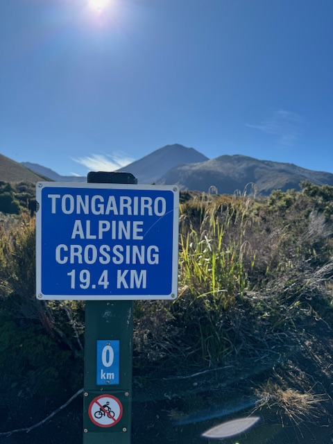
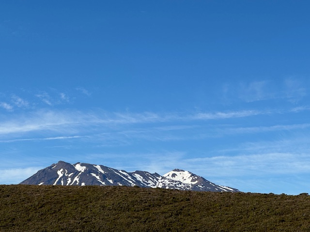
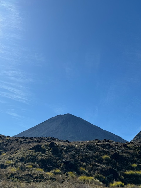
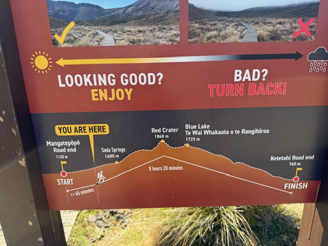
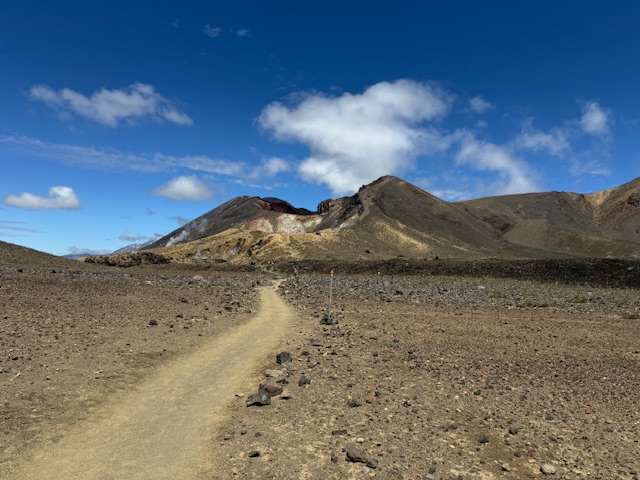
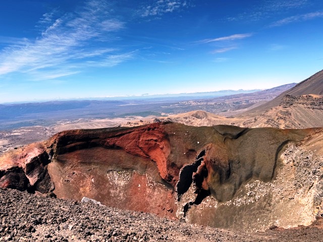
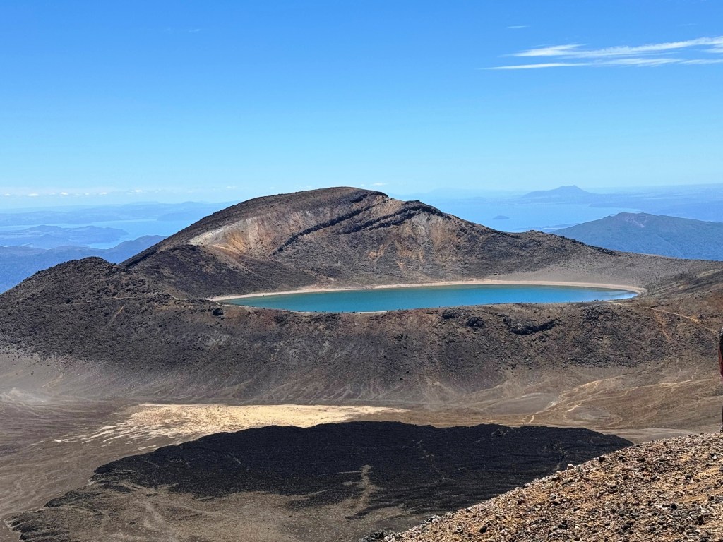
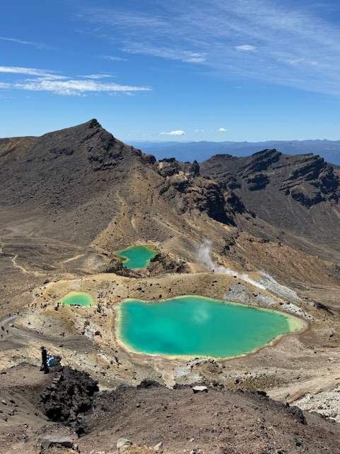
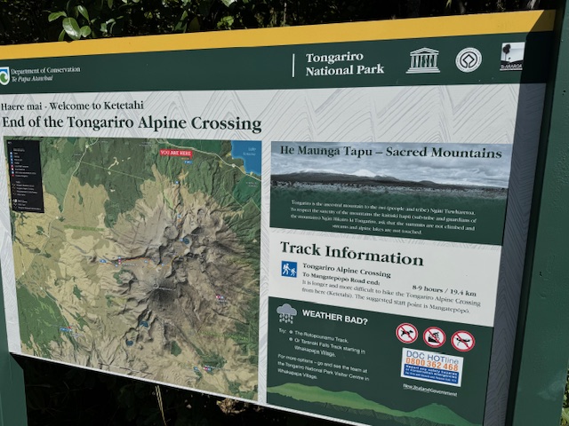
Tongariro National Park is a World Heritage Site, filled with towering peaks, lakes, tropical streams, desertscapes and also sites deeply significant and sacred to the Maori people. The crossing is a 19.4km (12m) trek up to high point among three volcanic peaks, overlooking sulfur steam vents and mineral fed, clear blue lakes, some of which are sacred to the Maoris and can’t be approached by non-natives.
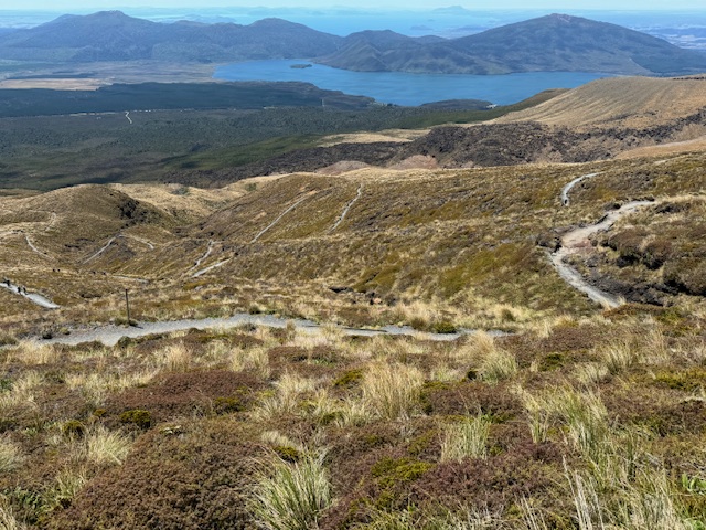
If it sounds amazing it is, but that also makes it extremely well-travelled. You don’t get this stretch of trail to yourself. There are daily shuttles that drop people off at the beginning and pick them up on the other side. It’s its own cottage industry. But none of that really matters, because as troublesome as humans sometimes are, the natural beauty of this place makes them a side issue.
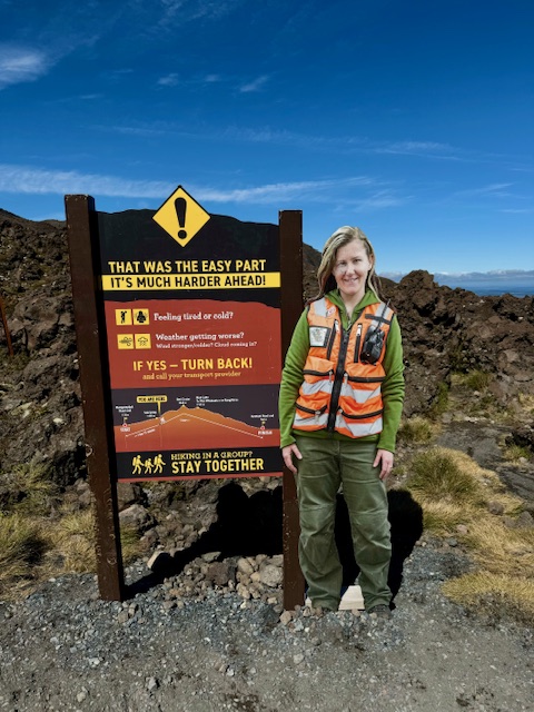
Oh, and it’s hard. 12 miles is a long way. The vertical gain is 1100m (3300ft). The footing is pretty tough in spots. And in summer, in New Zealand, the sun is brutal.
It was a great day.
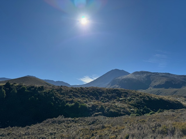
We got the late shuttle, because we chose to drive in from Taupo that morning, and so it was 9:30 or so by the time we got going. The heat of the day was already building, but the beginning of an adventure is always exciting, so we moved quickly through the first few, flat kilometers.
There were maybe 30-40 people who set out at the same time, so there’s also this natural sorting out of people and paces. The sign says no riding, but of course, I spent most of that first stretch thinking how much faster (and possibly more fun) it’d be to ride.
Early wind made the air feel cool, but quickly we pulled off jackets and midlayers and began to deal with sweat. We reapplied sunblock. We drank a LOT of water. In fact, they tell you not to start walking unless you’re carrying at least 3 liters of liquid with you. I burned through all of mine, no problem.
We saw plenty of people with maybe not the best shoes and maybe not even close to enough water. Some Belgian guys we found at the shuttle shelter at the very end begged us for just a little bit of water. They’d run out half-way in. I’m guessing it just doesn’t get this hot in Belgium.
What can I tell you that these images don’t? Well, we stayed in National Park, a small enclave just off the main road from Lake Taupo. If we had it to do again, I think we would have driven down the night before and gotten the early shuttle to the trailhead to get more hiking done before the heat really amped up.
We stayed at the Park Hotel Ruapehu and it was pretty perfect. The rooms are small and a bit minimalist but also perfect. A hot shower. A clean bed. And the hotel restaurant was all we could manage after a full day, and it’s a decent meal they make you there. Highly recommended.
